Streator has many parks available for you to enjoy.
We are located just 25 minutes from Starved Rock State Park, one of the most visited and popular State Park destinations in Illinois. The Streator area is also home to two public golf courses, and an impressive inventory of parks and open spaces—most of which have some unique connection to the history of Streator.
Click here for a city parks map from the City of Streator.
City Park - Spring Lake - Marilla Park - Hardscrabble Park - Central Park - Oakland Park - James Street Recreation Area - Hardscrabble Lions Dog Park - Heritage Park - Hopalong Cassidy Trail and Canoe Launch -
Anderson Fields - Southside Diamond - Bodznick Park
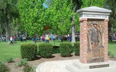
City Park – Many Midwestern cities have an entire city block set aside for use as a park. But when Streator was first laid out and platted, its founders had the vision to make their downtown park a 4-square block urban preserve. Over the years it has seen several different uses, and today it hosts a public amphitheater, fountain, splash park, picnic shelters, restrooms and several memorials; but more than two-thirds of the park’s area has been set aside as an urban forest preserve.
Location: 200 Block of N. Park St.

Plumb Pavilion
Splash Pad
Spring Lake Park – in the early years of the 20th Century before the advent of electric refrigeration, an ice house business operated west of Streator near the confluence of Eagle Creek and Egg Bag Creek. Here private interests installed a small dam that formed Spring Lake. Ice produced on the lake during winter months was cut and stored for sale during warmer months. When ice was no longer produced in this manner, the dam was destroyed and the lake drained, but the 35-acre park remaining retains this heritage in its name. The park is a popular hiking and picnicking location, and hosts the area’s only public equestrian trail.
Location: Spring Lake Road
Streator, IL 61364
Marilla Park – Approximately 33 acres of land on the northeast edge of the city was donated for a park in 1919 by the Plumb Family. It is the site of the city’s first drinking water source where a low flow dam was built on Otter Creek. In 2015, a local philanthropist donated an additional 32 acres, increasing the size of Marilla Park to approximately 65 acres. It is home to disc golf, mountain bike trails, picnic shelters and is large enough to accommodate group events.
Location: 1669 Marilla Park Road
Streator, IL 61364

Hardscrabble Park – Streator’s lighting system was first powered and supplied by a coal gasification plant on the east bank of the Vermilion River at the end of Cedar Street, giving residents piped gas for lamps long before electricity was available. When electric service came to town, the power utility purchased the site of the gasification plant from the city. Most of this site has been returned to the city and is now called Hardscrabble Park because it is also the site where some of the first settlers crossed the Vermilion River from the east. There are bluffs along much of the east bank of the river, but at this location the ‘hardscrabble’ up from the river was easier. This site will be the kick off point for more of the Greenway trails.
Location: Enter at the West end of Cedar St.
Heritage Park - Heritage Park was opened in 2012 with the efforts of the Streator Downtown Area Businesses. The park is a "pocket park" situated near the center of downtown Streator. The space features beautiful landscaping, a replica of the Kerr Clock, and numerous historic pieces including a glass bottle mold and a coal pick. The park also has a three story mural as its backdrop. During the summer, the park is host to the Jammin' at the Clock music series.
Location: Corner of Main and Monroe St.
Central Park - Central Park has a newly upgraded playground geared towards children ages 2-4. Inclusive swings and a two-seat for parent and child were also added. A concrete bicycle pathway was also added and is meant for young children to learn how to ride their bikes. 
Oakland Park – This park on the south side of Streator near a school with the same name was formerly a popular spot for neighborhood events when such gatherings were more commonly a part of the city’s social dynamic. It remains a location for family and neighborhood events. Surrounded by oak trees, this park still hosts gatherings in its picnic areas.
Location: Streator's East side (near the former Sherman School Site), Between E Hickory to the south and E Elm St to the North, and Wisconsin Ave and Indiana Ave.
James Street Recreation Area – Across the BNSF railroad tracks from Oakland Park is the sprawling James Street Recreation Area, formerly home to a railroad car repair facility, a meat processing plant and other industrial elements from the city’s past. In the 1970s the city acquired the property and slowly developed its current uses: multiple ball fields and support facilities for organized team sports. The city and Streator High School entered into an agreement to make James Street home to the Streator Bulldogs Soccer Team.
Location:820 James St.
Hardscrabble Lions Dog Park is located within the confines of the James Street Recreation Area. The dog park is split into 2 sides - small and big dogs. A shelter provides shade and benches are available for people to sit and watch their pet.
Dog Park rules are posted at the entrance of the park. 
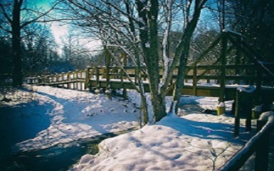
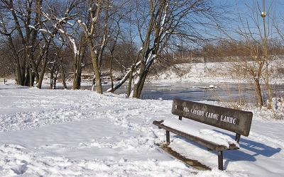
Hopalong Cassidy Trail and Vermilion River Greenway – Another of Streator’s favorite sons, Clarence Mulford (author of more than two dozen Hop-a-Long Cassidy novels) was born in Streator in 1883. His family’s home still stands along the banks of the Vermilion River on West Bridge Street, next to the trail that bears his name. The Hopalong Cassidy trail and canoe launch are part of the larger Vermilion River Greenway that preserves open spaces along the Vermilion River, and which contributed to Mulford’s boyhood experiences, some of which found their way into his written works.
Canoe Launch Location: 500 Block of West Main St. 
Anderson Fields Golf Course - Anderson Fields is a 9 hole public course and little has changed with its design since 1925. However, in 2008, a new club house along with golf cart storage and maintenance facility was built by the City allowing Andy Anderson's vision to continue for years to come. The course is a 2688 yard par 35 for the men and 2364 yard par 37 for the ladies. There are no tee times required and the course is open March through November, seven days a week, weather permitting. The course is also home to the Pluto Statue and Vin Fiz historical markers.
Location: 1901 N. Bloomington St.
Southside Diamond - Southside Diamond is home to Streator Youth Baseball.
Location: 619 Powell St.
Bodznick Field - Bodznick Softball Fields are home to Streator Girls Softball.
Location: 1002 E. Livingston St.
The city has other smaller ‘pocket’ and neighborhood parks. In the aggregate, the city has more than double the per capita allotment of public open space and park lands recommended by the National Parks & Recreation Association.
Train-watching in Streator – Once served by eight rail lines, Streator's remaining three railroads provide a daily glimpse into both historic and modern railroading. This was detailed by Bruce Stahl in the April 2017 edition of Trains magazine: Railroading in Streatorland

 facebook
twitter
instagram